
Canada is one of the pleasant places to live with abundant fresh water lakes and rivers, considerate population, lower incidence of violent crimes against international students and a good framework of health care system.
| Location: Canada lies towards the Northern half of North America, bordering the North Atlantic Ocean on the east, North Pacific Ocean on the west, and the Arctic Ocean on the north. |
| Geographic coordinates: 60° 00 N(42-83oN) and 95o 00W(53°W- 141°W) |
| Map references: North America |
| Area:
Canada is the second largest country in the world and ranks fourth in terms of area. land:9,093,507 km2 water:891,163 km2 |
| Area -comparative: Canada is slightly less than three-fifths as large as Russia and slightly larger than Europe. In total area, Canada is slightly larger than both the U.S. and China. |
| Land boundaries: US to the south- 8,893 km (includes 2,477 km with Alaska) |
33,476,688 with81% urban population and 19% rural population. All the four provinces(Quebec, Ontario, British Columbia and Alberta) accounts majority of the population but, Ontario is the most populous province of the country with 38.4% of the population.
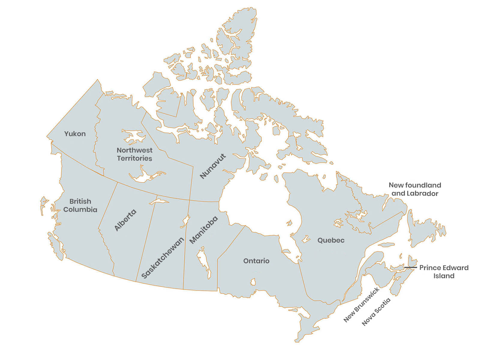
| LARGEST STATE: | Nunavut |
| SMALLEST STATE: | Prince Edward Island |
| LARGEST CITIES: | New York, Los Angeles, Chicago, Houston,Philadelphia, San Diego, Detroit, Dallas, Phoenix, San Antonio |
| BORDER COUNTRIES AND OCEANS: | Canada is bordered on the east coast, by the Atlantic Ocean, the west coast by the Pacific Ocean, and the north by the Arctic ocean and United States of America to the South. |
| LANGUAGES: | English 78.3% , French 21.7% , Non-official languages 2%(Punjabi, Chinese, Spanish, German, Cantonese, Italian) |
| RELIGIONS: | Canada has no official religion, and the government is officially committed to religious pluralism. Majority of Canadians are Christians, representing 67% of the population and Islam, second largest religion practiced by 3.2% of the population. |
